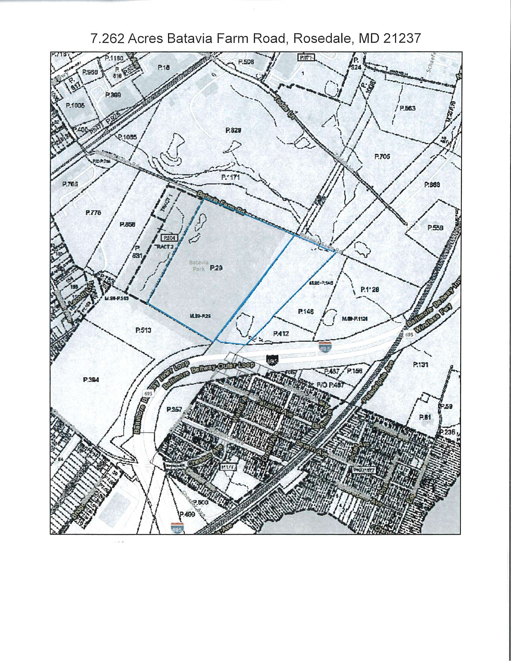
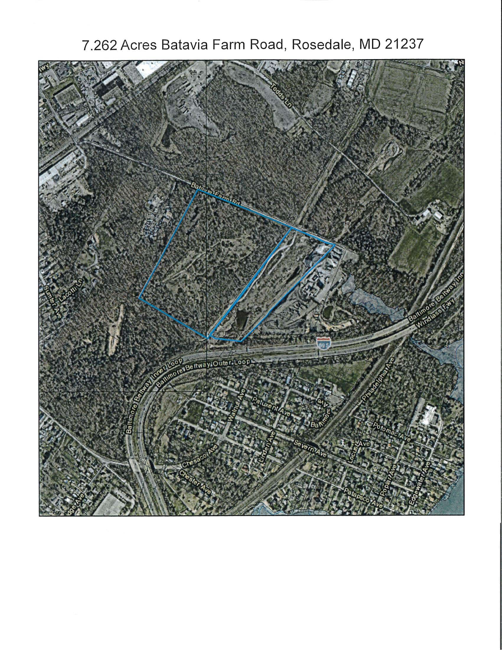

Batavia Farm Road, Rosedale, MD 21237
All of the Grantor’s right, title and interest in that certain unimproved parcel of land, lying, being and situate in Baltimore County, being more particularly described as follows, said parcel being subject to all covenants, conditions, easements and restrictions as the same may be recorded in the Land Records of Baltimore County.
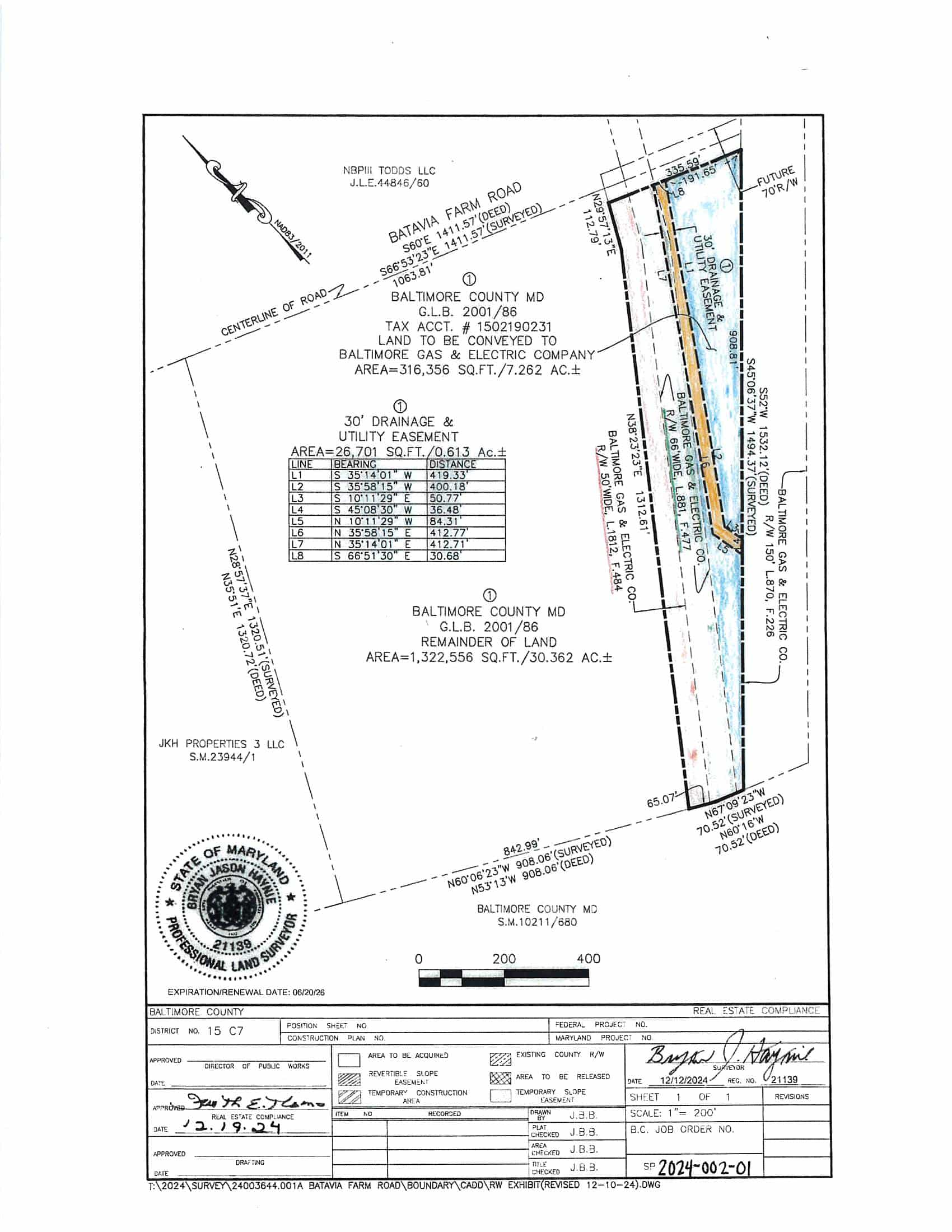
BEGINNING for the same at the beginning of the third or North 60° 16′ West 70.52 foot line of that parcel of land described in a deed to the County Commissioners of Baltimore County, dated August 3, 1951, and recorded among the Land Records of Baltimore County in Liber GLB 2001, Folio 86. Thence running with and binding on the third and part of the fourth lines of said deed, as now surveyed and referenced to the Maryland Coordinate System (NAO 83/2011)
1) North 67° 09′ 23″ West 70.52 feet to a point, thence
2) North 60° 06′ 23″ West 65.07 feet to a point, thence leaving said fourth line and running through the property described in the aforementioned deed
3) North 38° 23′ 23″ East 1312.61 feet to a point, thence
4) North 29° 57′ 13″ East 112.79 feet to a point, thence
5) South 66° 53′ 23″ East 335.59 feet to a point, thence
6) South 45° 06′ 37″ West 1494.37 feet to the place of beginning.
CONTAINING 316,356 square feet or 7.262 acres of land, more or less.
BEING a portion of that parcel of land conveyed to the County Commissioners of Baltimore County in a deed, dated August 3, 1951, and recorded among the Land Records of Baltimore County in Liber GLB 2001, Folio 86.
SUMMARY TERMS: A cash deposit or certified check made payable to “Baltimore County, Maryland” in the amount of $100,000 will be required of the purchaser at the time and place of sale. All cash deposits or certified checks shall be delivered to the escrow agent, Atlantic Auctions, Inc. (“Atlantic”), at 4692 Millennium Drive, Suite 101, Belcamp, Maryland 21017. All deposits shall be held by Atlantic in a non-interest-bearing escrow account to be applied to the purchase price at the time of settlement or distributed in accordance with the terms hereof, in the event of default. The balance of the purchase price must be paid on the date of settlement.
The Property will be sold in an “AS IS/WHERE IS” condition without any representations or express or implies warranties of any nature whatsoever. In particular, the County makes no representation or warranty with respect to: (1) the existence, validity, scope, or nature of any zoning, land use, development, site plans, occupancy or other governmental permits or approvals with respect to the Property; (2) fitness for any particular purpose or use; (3) flood zone designations of the Property; (4) compliance of the Property with any zoning or building laws, regulations and ordinances; (5) ingress, egress or access to the Property or any portion thereof; (6) the rights of any parties in possession, or the existence, validity, terms or conditions of any lease of all or any portion of the Property; (7) the existence of any security deposits or rental payments; (8) compliance of the Property with the Americans with Disabilities Act; or (9) the condition of the Property, of any nature whatsoever, including any prior or current environmental contamination or the presence or absence of any hazardous materials on or in the Property.
PLEASE READ THE LEGAL AD FOR COMPLETE TERMS AND CONDITIONS.
"*" indicates required fields



 Auction Advertisement - Batavia Farm Road Baltimore County - FINAL